(02-15-2025, 05:20 PM)marlia7568 Wrote: I have two maps of London that I want to merge them into one. The problem is, the maps are not quite aligned to each other and it vexes me to no end on this problem. If you guys know how to do this, please help me. Thanks you for reading.
You want to join North above South ? Not difficult if you take it slowly but still plenty for a Gimp beginner to absorb.
1) Since these are large images ~ 15000x9000 pix I recommend a bit of pre-join preparation.
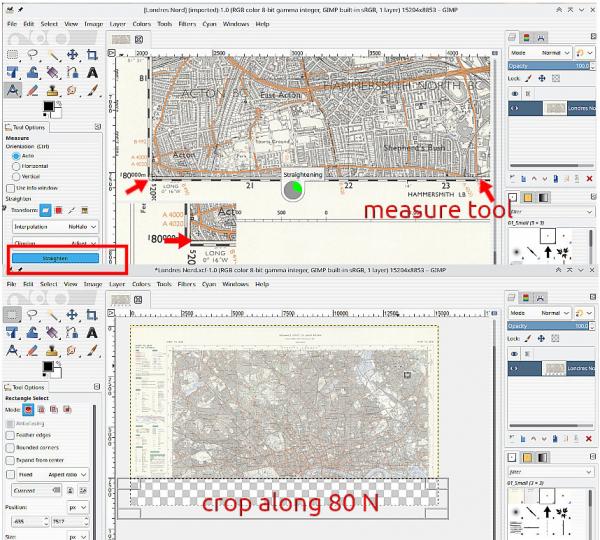
2) For the North, use the measure tool along the 80 deg north line. Be very precise with the start and end of the measure line, it is used to straighten the image. Click on the straighten button and wait for it to finish.
Now use the rectangular select tool carefully along that 80N line and cut out the bottom of the image. Kill the selection and save the image as a Gimp .xcf which keeps the transparency.

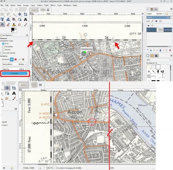
3) Now for the South Map. Same procedure for straightening, measure tool (carefully and precise) and save it.
To assemble the pair, With the South open,
File -> Open as Layers the North image
Use
View -> Show all to see outside the canvas size.
Use the Move tool to shift the North up.
Do not click and drag. Use the keyboard cursor keys. SHIFT-UP moves in large increments, UP is pixel size. Use the grid lines to get a match.
Image -> Fit Canvas to Layers and
Image -> Merge Visible Layers to finish. Remember to turn View -> Show all off.

Not a bad fit, some lettering on the border scrambled. You should note that the Ordnance Survey sometimes include deliberate errors to catch out copyists. Bit of a strange railway cutting there

There are other non-Gimp tools, Hugin should do it and also one called NIP2 but try Gimp, it is good practice.


